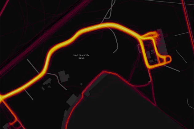
Strava heatmap around MoD Boscombe Down

Strava's updated global heatmap has revealed the location of sensitive military bases, with military analysts expressing concern over the weekend that the information could affect security.
As military personnel on the bases use Strava to log their cycling and running activities, details of the military bases are revealed – including how much activity there is within them.

Thank you for reading 20 articles this month* Join now for unlimited access
Enjoy your first month for just £1 / $1 / €1
*Read 5 free articles per month without a subscription
Join now for unlimited access
Try first month for just £1 / $1 / €1

-
 British Paralympian found alive and safe after missing person report
Sam Ruddock hadn't been heard from in 11 days, but has now been located
-
 Tadej Pogačar was dominant at Liège-Bastogne-Liège, but I hope for a competitive Tour de France
The Slovenian has finished on the podium of the last six Monuments, the first man to do so - when will he stop dominating?


-
 Tadej Pogačar bags handful of Strava KOMs in Tour of Flanders onslaught
Slovenian tops the leaderboards on several verified segments but does not get flagged for efforts
-
 I'm hooked on Strava and I don't care who knows about it
People are ditching their social media apps, but I could never let go of the oasis that is Strava
-
 Strava clamps down on vehicle cheats in new update
App makes improvements to leaderboard monitoring, Athlete Intelligence feedback, and Flyover maps
-
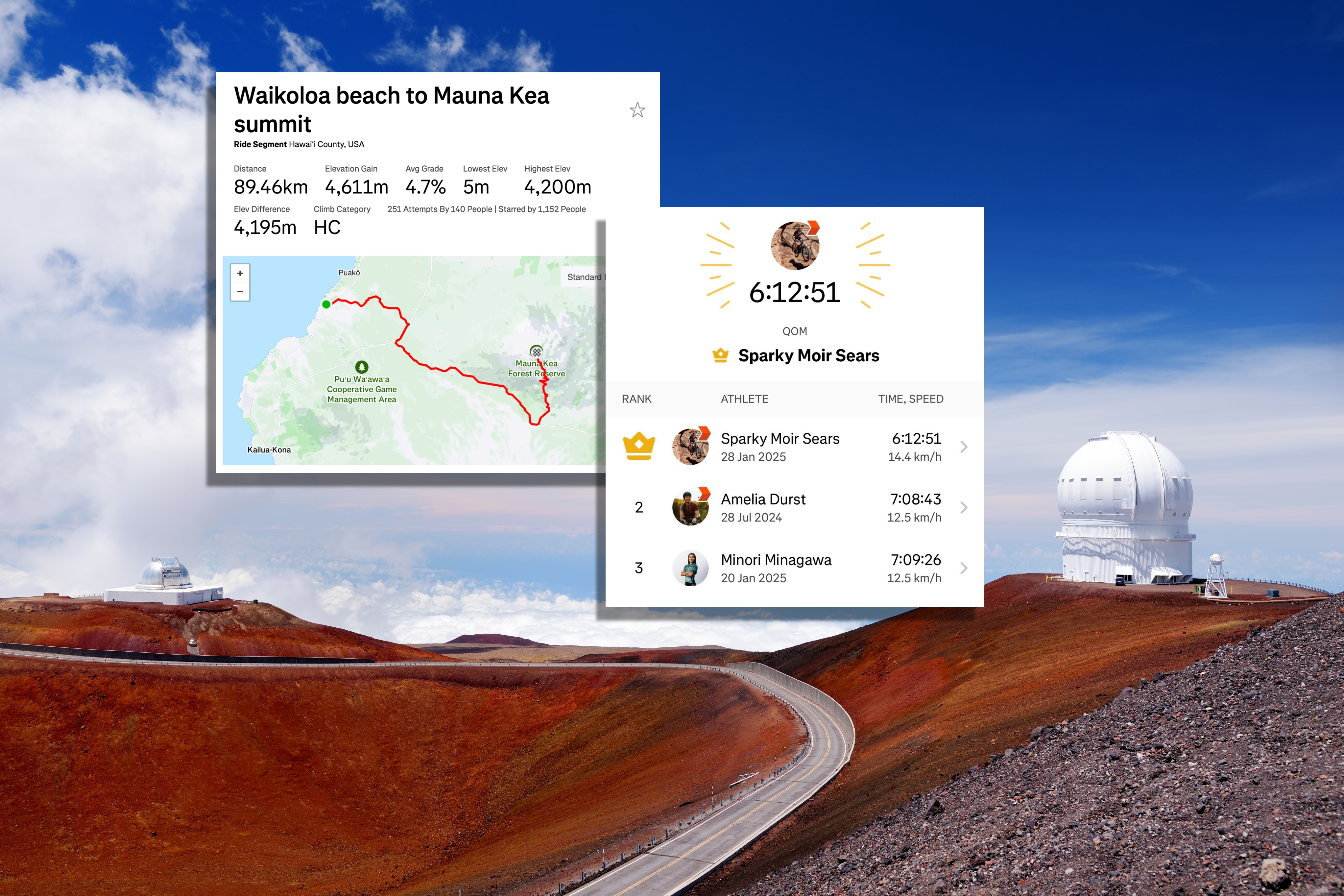 Cyclist breaks Strava record on 'world's tallest mountain' by almost an hour
Mountain biker Sparky Moir Sears smashes QOM on Mauna Kea volcano
-
 Tadej Pogačar smashes the Strava KOM on the Coll de Rates
World Champion sets a time of 12:21 on the segment, beating Peter Øxenberg Hansen by 17 seconds
-
 Last-minute gifts cyclists will love: gift subscriptions to Strava, Ride with GPS and more are just a click away
From indoor training to Tour de France streaming and magazines, these gifts will keep your cyclist pedalling happily in 2025
-
 Forget distance covered, these are the key stats to note in your Strava Year in Sport
We asked a coach how to best analyse our end of year Strava data
-
 Amateur cyclist in talks with four WorldTour teams after Strava KOM heroics
Jack Burke says there's a 30% chance he'll ride at cycling's top level in 2025


