Are you getting the most out of Strava? Five tools to enhance your Strava experience
Whether it’s deeper analysis, stitching together activities or showcasing your ride, there’s a lot more you can do with Strava integrations


Now boasting over 100 million users, Strava is fully woven into the heart of cycling. Where would we be without segments to battle over, kudos to give and such wise proverbs tackling philosophical conundrums such as: “if you go for a ride but don’t post it on Strava, did it happen?”
The platform harbours so many neat features, tools and tricks. To just scratch the surface, there’s the route builder and global heatmap; the fitness and freshness tracker for balancing training load; ride analysis tools; and the connection it allows with the wider community. Yet still there’s more - so much more - that can be added.
Whether it’s providing deeper analysis and a whole new range of stats to pour over, or the more fundamental repairing of GPX files and stitching together of rides, or simply building a slick showcase for a particularly epic ride – there's a huge variety of applications and add-ons to get stuck in to.
Some of these require their own subscription, some of them don’t. But they all add an interesting extra dimension to your Strava experience. Let's get stuck in.
Veloviewer
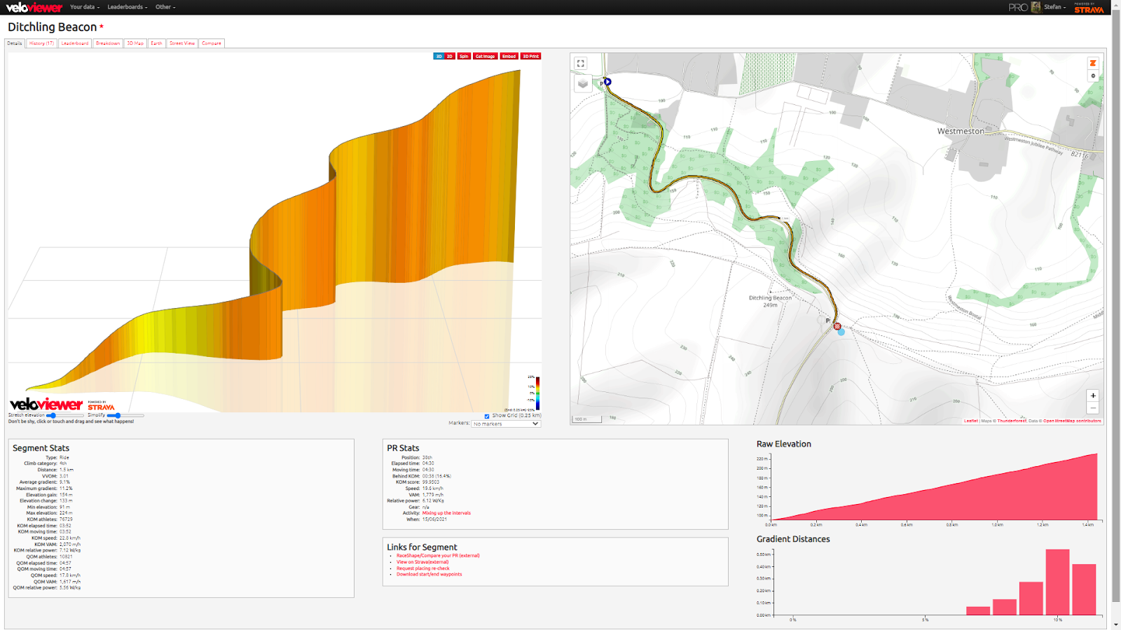
Drawing on the masses of data from Strava’s API, Veloviewer cuts this up and displays it in so many fascinating ways. The elevation data from the segments is an obvious one, with brilliant graphics depicting the gradients, distance and all the twists and turns of the hills in one instantly digestible image. It’s no wonder that so many pro teams rely on the platform.
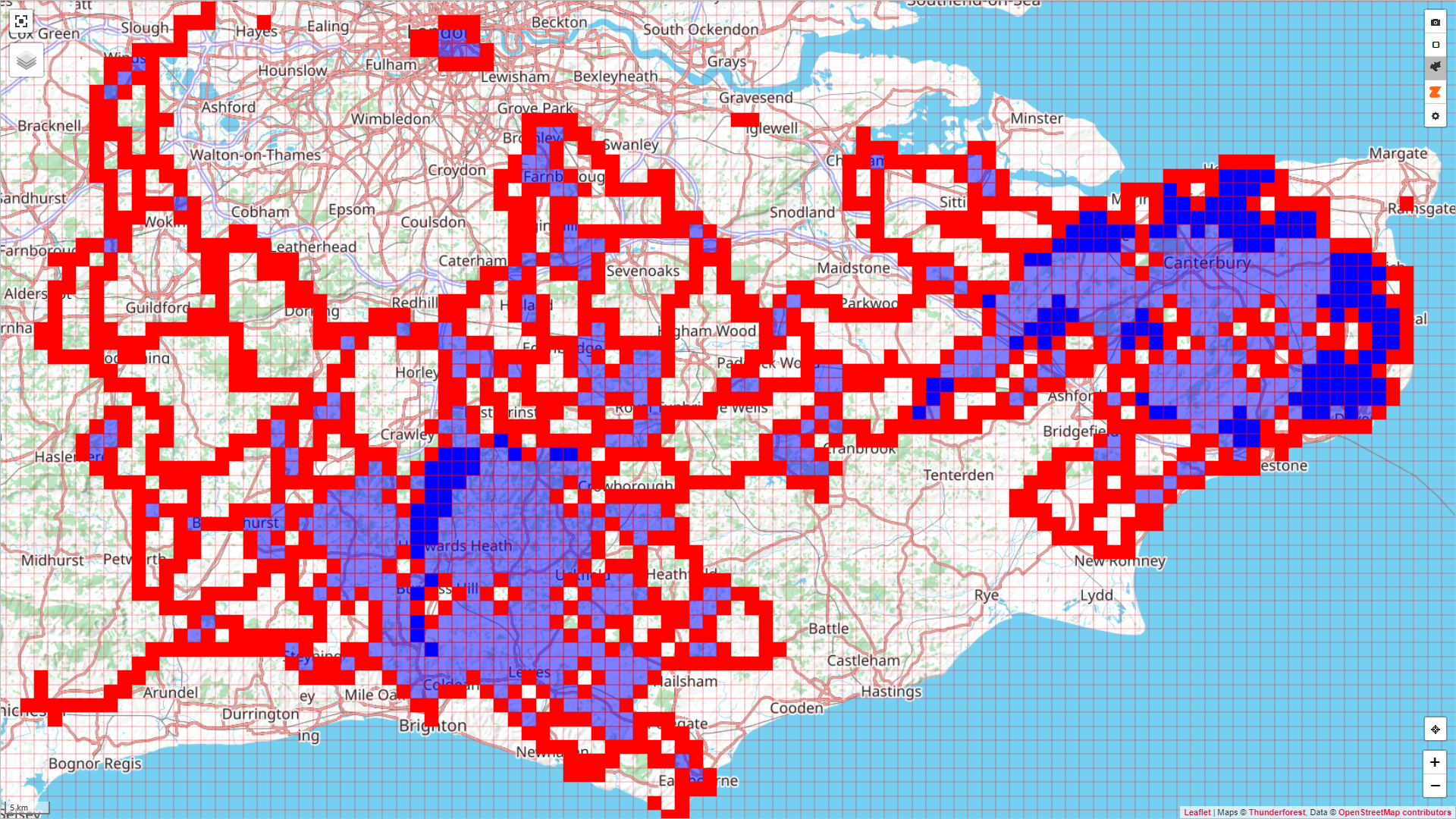
But beyond that there are so many excellent features, with ‘tile bagging’ (second in the gallery) being a notable one. Instead of obsessing about how fast you can ride a certain stretch of road, how many different stretches of road can you get yourself onto? The map is divided up into a certain number of squares and the goal is to get yourself into as many squares as possible. Like Strava’s local legends, it's a different set of metrics and goals to organise your rides by - if that’s what you’re into.
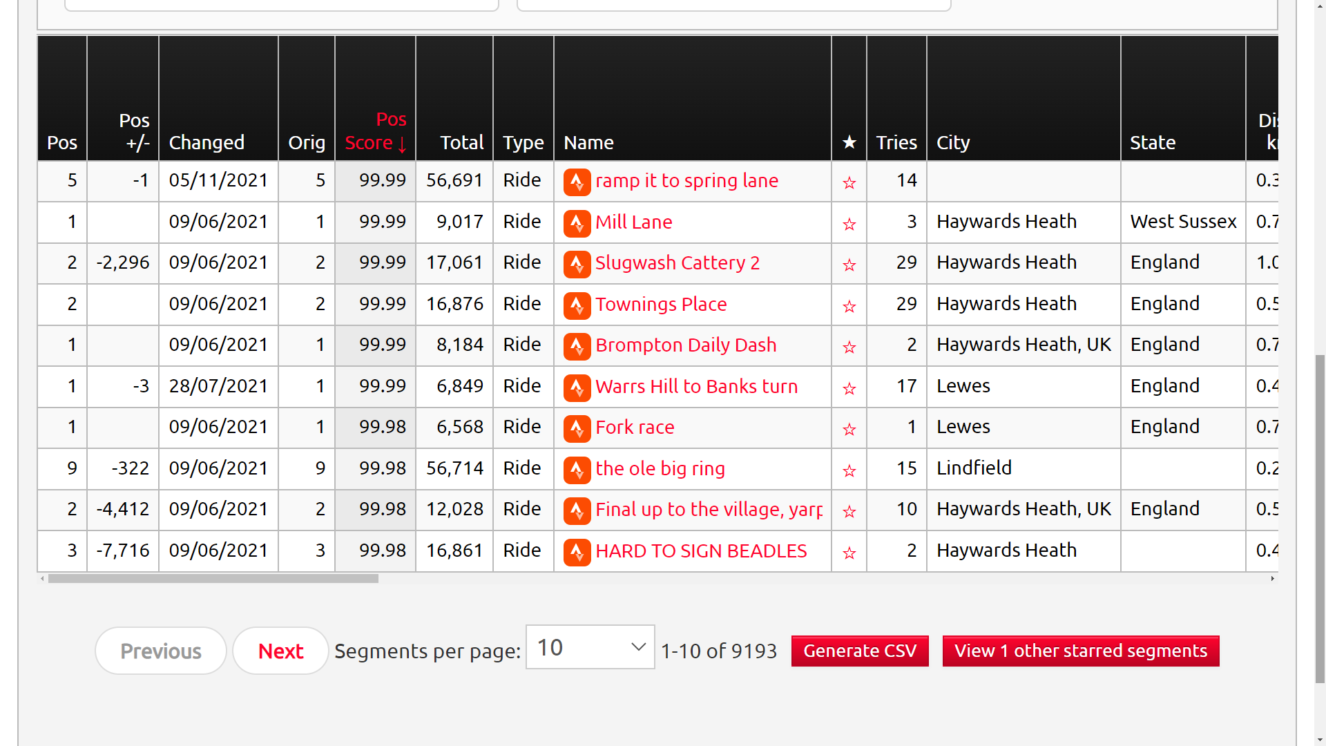
But of course, in hoovering up all the data from Strava’s API, there’s a lot of very KOM / QOM heavy touches. Although the very best amongst us may gauge their rides by the sheer quantity of KOMs / QOMs hoovered up – perhaps counting them in the pages rather than each individual title – for most of us even entering a top ten is a notable achievement.
The latest race content, interviews, features, reviews and expert buying guides, direct to your inbox!
So it is nice to keep track of where you’re ranking for those, and Veloviewer lets you do that (third in the gallery). It even generates a "Strava score" contextualising your achievements – coming 50th on a climb in a world tour race is much more impressive than a KOM around your housing estate, and Veloviewer takes that into account.
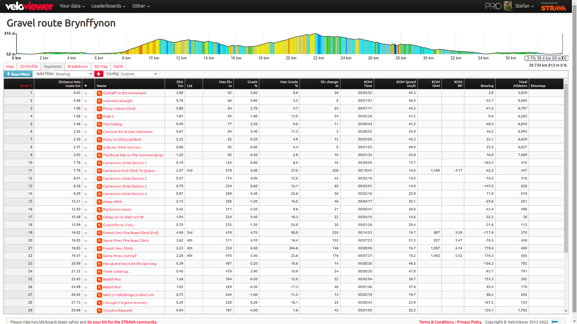
Also, for better hunting of segments, if you plan in your route, it’ll tell you at what distance through your route the segments will be coming up, so you can note down on your stem when to go (fourth in the gallery). The map will also let you filter segments by so many parameters, distance, gradient, KOM time, to help you tailor your search to the segments you’re after, for the training benefit you need.
There is a subscription to access all of this and more details can be found on veloviewer.com
Mywindsock
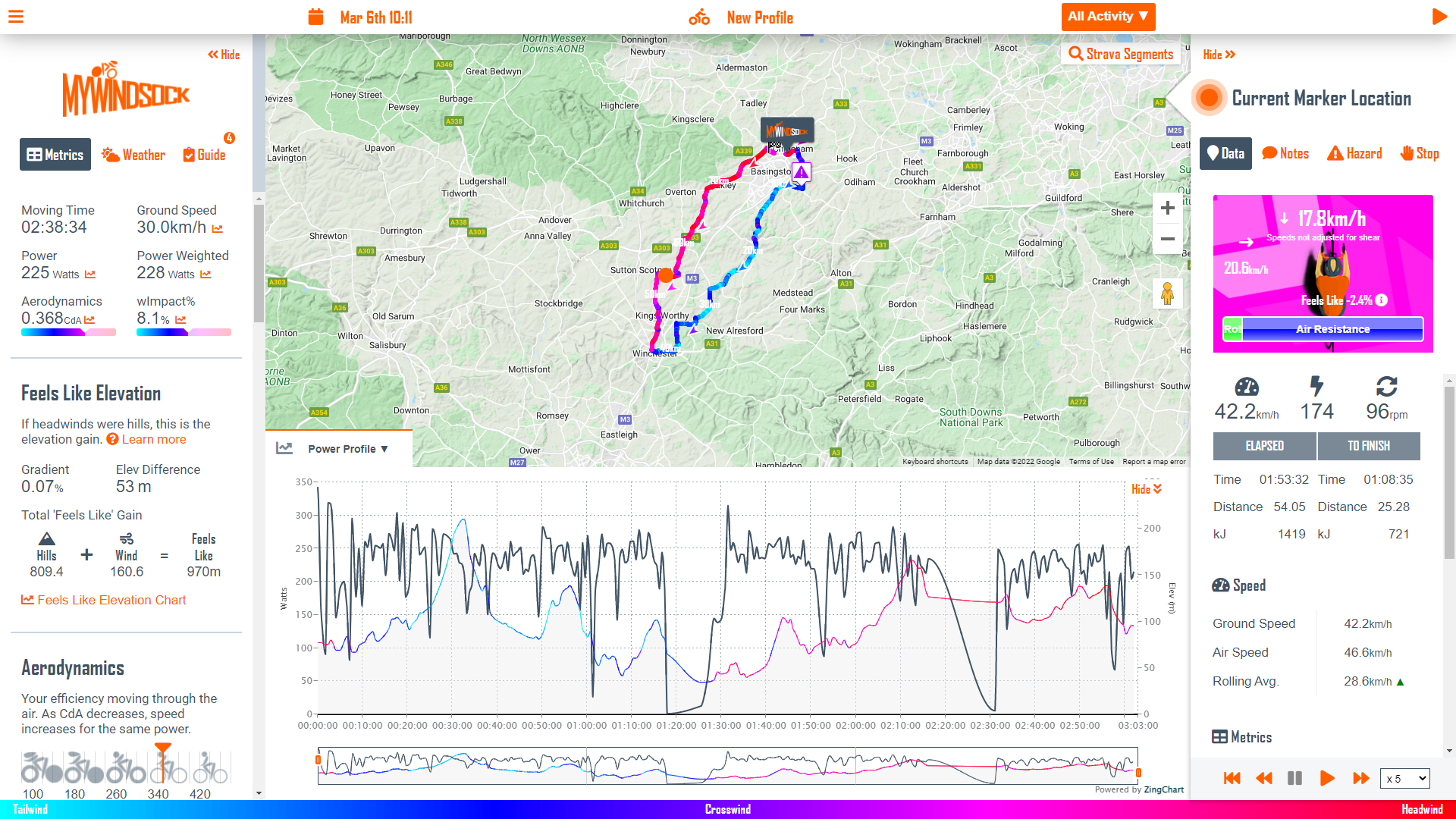
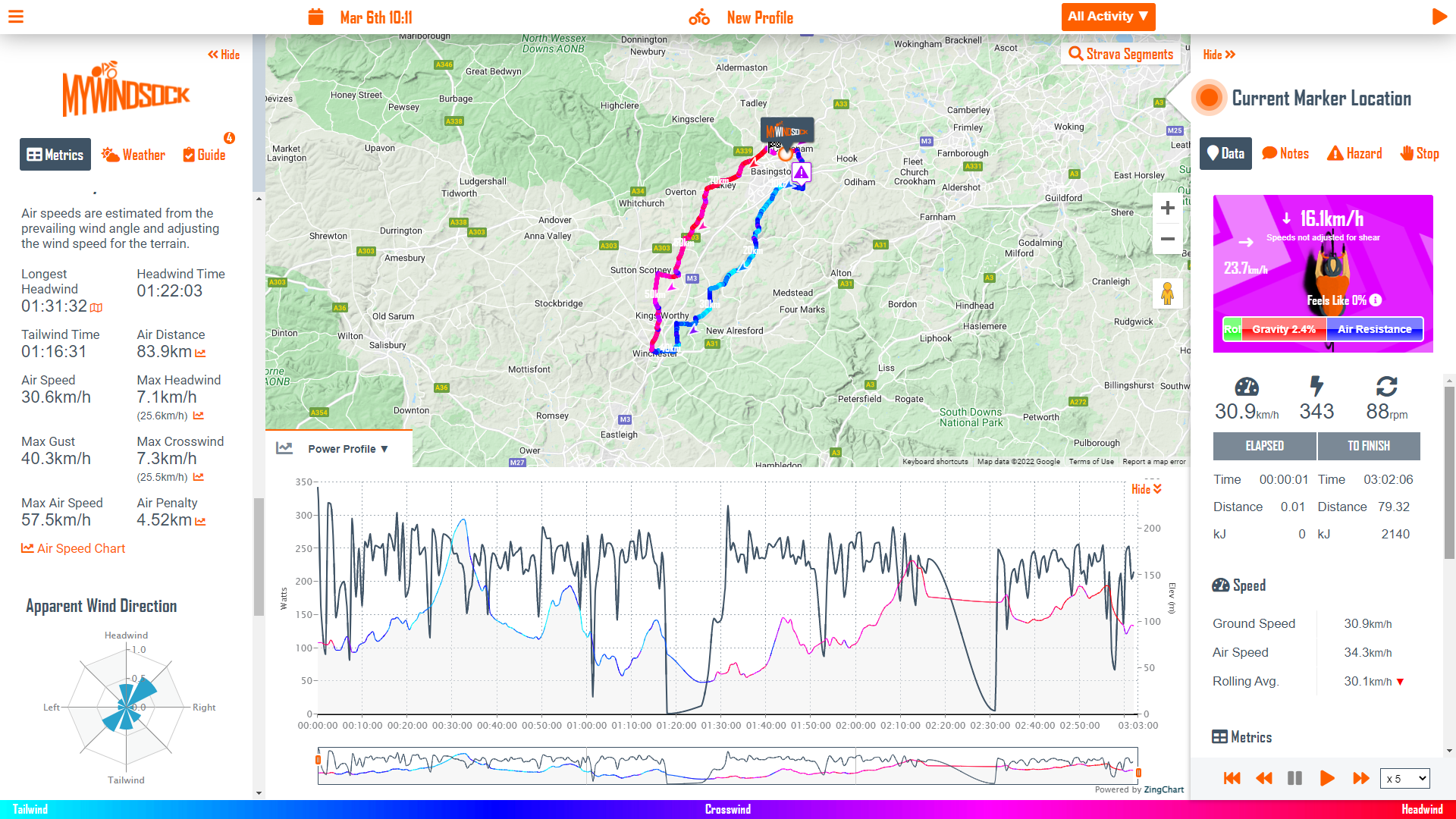
The weather plays such a large role on our rides - it’s nicer to work with it than against it. You might look at a local weather forecast for the chance of rain and the wind speed and direction. But that doesn’t really help when your ride takes you further afield.
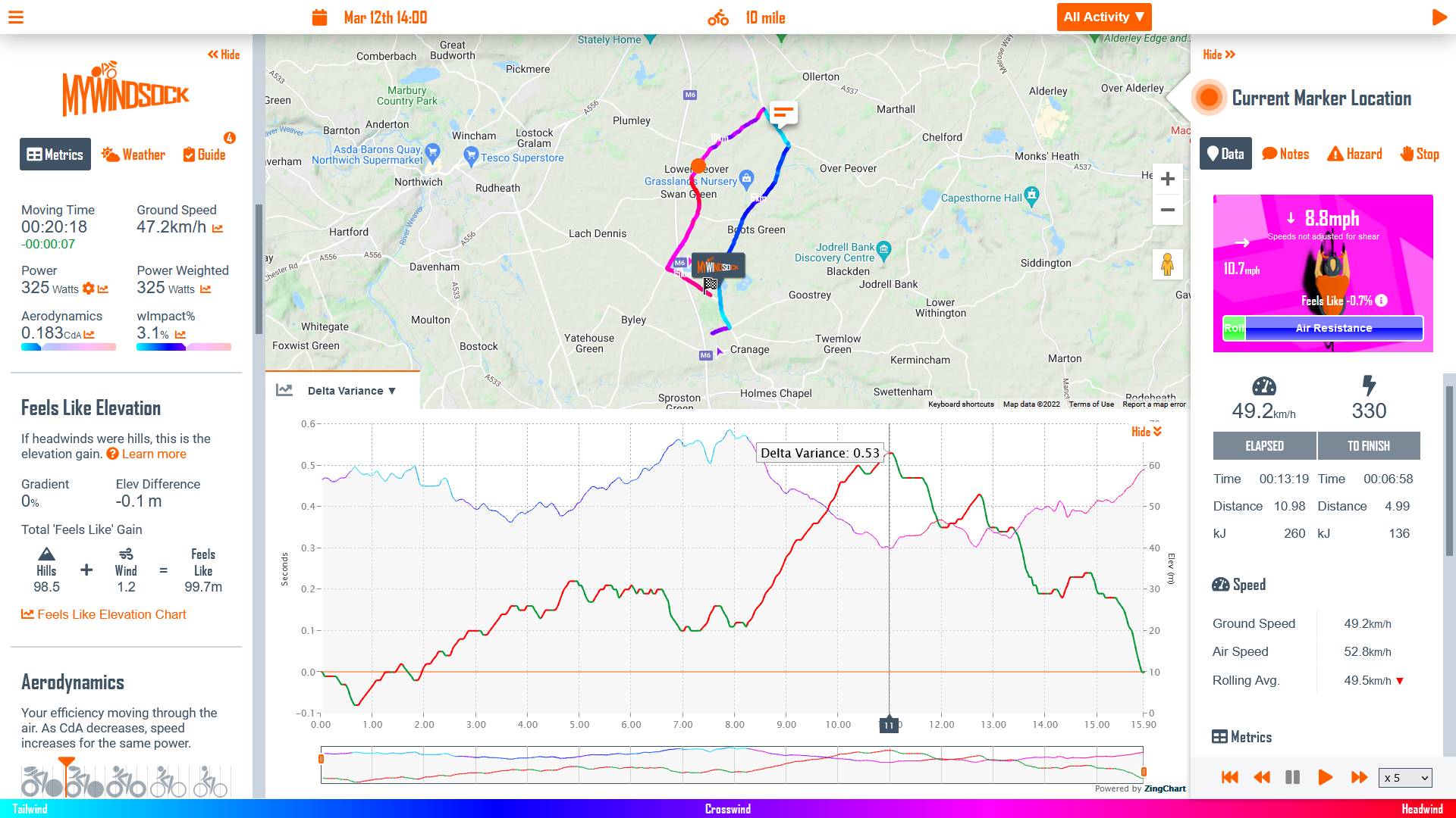
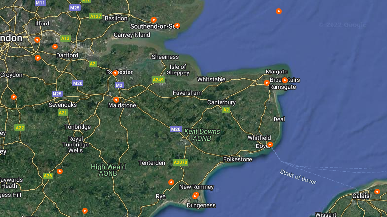
Mywindsock pulls hyperlocal forecasts from around a plotted route. Then, using the anticipated progress of the rider, this data is pulled together to get the most accurate forecast for the anticipated time and location, point by point.
You can use this to plan your routes, perhaps getting the climbing done with a tail wind and descend into the headwinds – evening out those grads and breezes. If your ride involves big chunks of inland and coastal riding, it can help show you which way to go to make the most of the sea breezes.
Analysing your ride afterwards is quite fun too. Mywindsock pulls the recorded wind data from nearby weather stations and weights these accordingly. It lets you see exactly how much time you spent ploughing into a headwind, what the forces limiting your speed were at any given point - be it rolling resistance, gravity or air resistance.
You can also use it for planning your optimal pacing strategy in time trial events. Mywindsock has all the UK events already listed on the website for a quick look up, but you can upload your own files for other events. Seeing the predicted wind data, you can know when’s best to go hard and when’s best to recover.
This application does require a subscription and you'll really want to be riding with power to get the best out of the data it provides. You can find out more on mywindsock.com
Doogal segment search
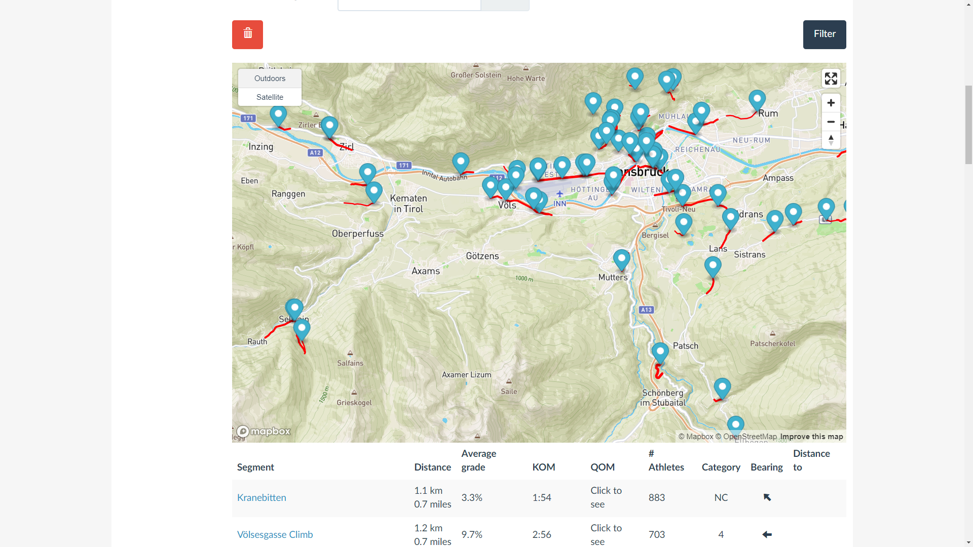
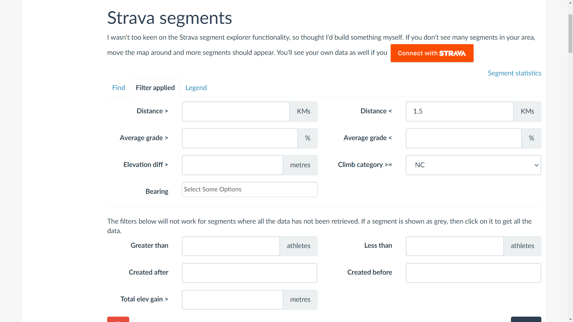
Strava's segments are great for motivation and can be a fun way to spice up an interval session by injecting a bit of healthy competition. But finding ones that exactly fit the efforts you want can be a bit of a pain – Strava does its own segment explorer, but it isn't very granular in its searching.
This where the segment explorer on doogal.co.uk comes in. This free to use site allows you to filter segments for a specific gradient and length, which really helps to narrow down the search.
You can also filter for the number of athletes, helping to find segments that are sufficiently competitive (or sufficiently uncontested) to target. There's a whole range of other filters and functions too – you'll find which are useful to you quickly enough.
If Everesting is on your mind, this segment search tool is also particularly useful for hunting down climbs that are long and steep enough for an efficient time.
Gotoes
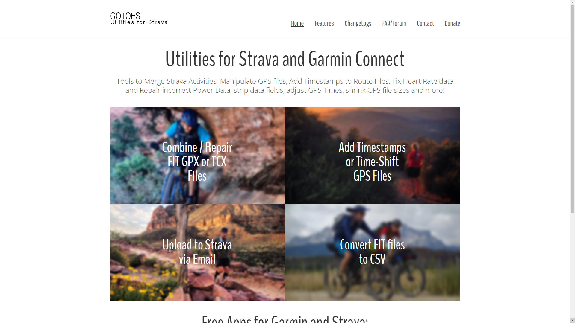
More of a utility than a source of extra functionality – but that makes it probably the most useful application here.
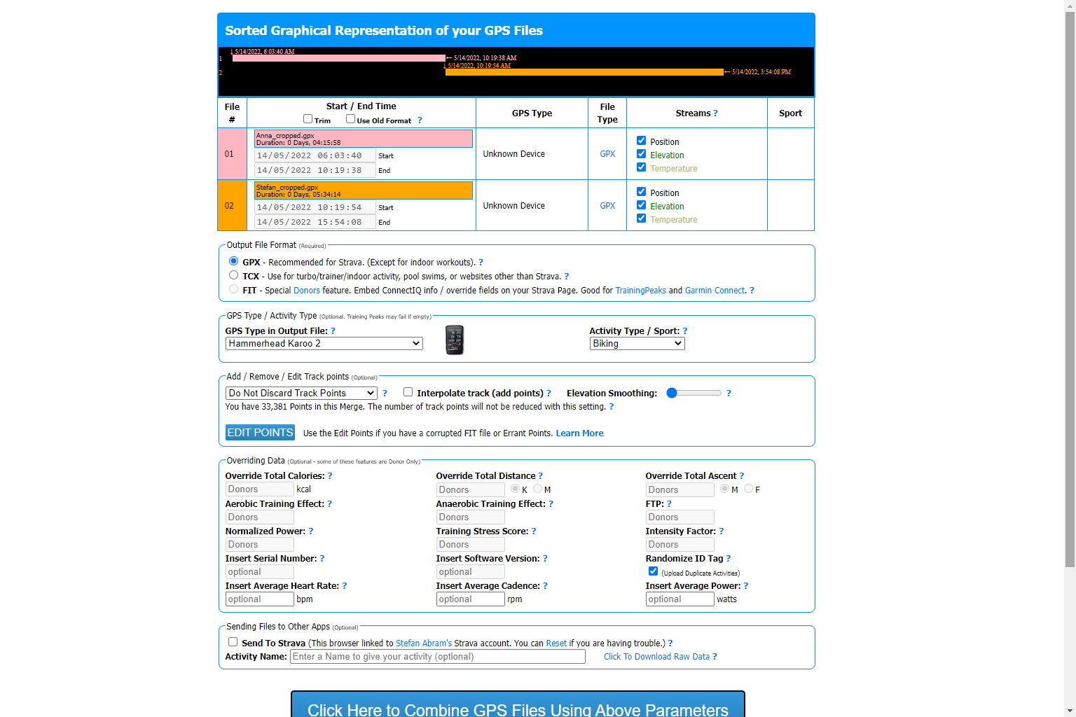
We've surely all had the frustration of recording a ride in chunks and wishing the files were combined into the one long epic ride it was. Well, Gotoes lets you do precisely that – and quite a bit more besides.
You can also strip out certain data fields from your files, which is very useful if your heart rate or power data were playing up during a ride. There's also the ability to randomize the ID tag, which allows duplicate activities to be uploaded to Strava.
Normally it's a blessing that Strava can recognise that an activity is a duplicate, but if you've gone for a ride with someone and their headunit didn't record, it's nice to be able to send over a duplicate file so they can upload the ride on their own account too.
There's loads of other useful functions, so well worth playing around. gotoes.org is free to use, but if you find you are turning to it often, there is the option to donate to the upkeep of the site.
Avyri
(Click this link here to view on mobile)
For particularly significant rides, Avyri.com is an application for creating short videos that trace your GPX trail across the countryside. There a lot of scope for the placing of your photos and adjusting the playback speed and 'camera' angle - you can really let your creative side go wild.
There is a subscription to get all the features, but if you're after a slick way of sharing your loops it is worth paying that bit extra.
Those are our top picks, but there's plenty more apps out there to further enhance your Strava experience!
After winning the 2019 National Single-Speed Cross-Country Mountain Biking Championships and claiming the plushie unicorn (true story), Stefan swapped the flat-bars for drop-bars and has never looked back.
Since then, he’s earnt his 2ⁿᵈ cat racing licence in his first season racing as a third, completed the South Downs Double in under 20 hours and Everested in under 12.
But his favourite rides are multiday bikepacking trips, with all the huge amount of cycling tech and long days spent exploring new roads and trails - as well as histories and cultures. Most recently, he’s spent two weeks riding from Budapest into the mountains of Slovakia.
Height: 177cm
Weight: 67–69kg