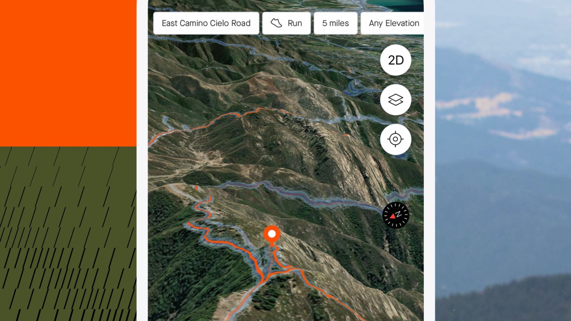
Strava's latest update adds 3D maps to its mobile apps
The update is free and offers users a 3D terrain view of their surroundings

The latest race content, interviews, features, reviews and expert buying guides, direct to your inbox!
You are now subscribed
Your newsletter sign-up was successful
Strava has added 3D maps to its Android and iOS apps with its latest update, released over the course of yesterday (Thursday).
The update offers a 3D terrain view designed to make it easier for athletes to visualise elevation changes and topography of a route, segment or activity. This benefits riders seeking both challenging climbing routes and more comfortable journeys. It is available to Strava premium members only, providing "added value" to those who pay for the subscription.
The activity-tracking company first introduced 3D maps within personal heatmaps in April 2021, but users could only view this feature on the web. Now though, Strava says the update will make planning routes simpler, with athletes able to pinpoint their precise location, helping them to make informed decisions when moving.
Strava said: “This update will allow Strava premium athletes to confidently plan adventures and hit trails with ease, visualise the difficulty of different journeys, and make informed decisions on the go.
“It also signifies the next step in making Strava the ideal workout partner for trail sports athletes, who can hit unfamiliar trails knowing what they’re in for and how they get home."
To access the latest feature on the app, navigate to the 'Routes' or 'Record' tab, or click on any activity map. Toggle the map layer to 3D in the top right of the screen, and there you will be able to see a multi-dimensional view of your surroundings.
This update follows the 'Points of Interest' feature, designed to help athletes plan where to find essential amenities while on the move. Strava identified the most popular spots and locations for its users for that update, and adding 3D maps to phone apps will enhance that feature even more now.
The latest race content, interviews, features, reviews and expert buying guides, direct to your inbox!
Strava also plans to use mapping data designed for athletes rather than cars in future updates.
It said: “Our team is working closely with cartographers from MaxBox to optimize our maps for the needs of our community.
“Beyond adding Points of Interest, you’ll see lots of smaller improvements to our maps including clearer trails and trail networks and removing highway labels and other common car-centric information that athletes don’t need when moving under their own power.”
Ryan is a staff writer for Cycling Weekly, having joined the team in September 2021. He first joined Future in December 2020, working across FourFourTwo, Golf Monthly, Rugby World and Advnture's websites, before making his way to cycling. After graduating from Cardiff University with a degree in Journalism and Communications, Ryan earned a NCTJ qualification to further develop as a writer.